Restaurant nearby Dar Ward Restaurant
Egypt
Restaurant nearby Dar Ward Restaurant
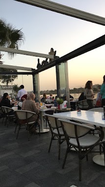
Dar Ward Restaurant
Al Omraneyah Egypt
contacts phone
:
+20
Latitude:
29.9741067
, Longitude:
31.2342948
read more
nearest Restaurant
24 m
The Platform
12/8 Corniche El Maadi, Maadi as Sarayat Al Gharbeyah, Al Maadi
Restaurant
read more
32 m
Cortigiano Maadi - The Platform
Restaurant
read more
35 m
Cortigiano Restaurant Maadi
Platform Maadi, 12/8 Corniche El Maadi, Maadi as Sarayat Al Gharbeyah, Al Maadi, Cairo Governora, Cairo
Restaurant
read more
83 m
Rio
Restaurant
read more
92 m
Margin Coffe Cup
Restaurant
read more
132 m
mezaj cafe and restraunt
Corniche El Maadi
Restaurant
read more
612 m
Hadith El Gezirah
Al Isaweyah, Al Basatin
Restaurant
read more
660 m
Negmet El Gazeira
Al Isaweyah, Al Basatin
Restaurant
read more
782 m
Kribiano
Un Paved Road, Al Isaweyah, El-Basatin
Restaurant
read more
848 m
El Embrator
Al Isaweyah, Al Basatin
Restaurant
read more
855 m
Marwa
Al Isaweyah, Al Basatin
Restaurant
read more
865 m
Awlad Soltan
Al Isaweyah, Al Basatin
Restaurant
read more
874 m
Baskal
Al Isaweyah, Al Basatin
Restaurant
read more
885 m
El Matry
Al Isaweyah, Al Basatin
Restaurant
read more
903 m
Halawet Zaman
Al Isaweyah, Al Basatin
Restaurant
read more
934 m
El Zamly
Al Isaweyah, Al Basatin
Restaurant
read more
938 m
El Safah
Al Isaweyah, Al Basatin
Restaurant
read more
961 m
Sea Horse Club
Restaurant
read more
976 m
Sama El Togaraia
Al Isaweyah, Al Basatin
Restaurant
read more
976 m
Awlad Abd El Ghany
Al Isaweyah, Al Basatin
Restaurant
read more
1.068 km
Ondine Restaurant
مطعم اوندين
Restaurant
read more
1.08 km
El Sharkawy
Athar an Nabi, Misr Al Qadimah
Restaurant
read more
1.118 km
Abo Saif
Al Isaweyah, Al Basatin
Restaurant
read more
1.143 km
Ondine Elmaadi
Restaurant
read more
1.249 km
Nile Corniche
Nile Corniche, Imbaba
Restaurant
read more
📑
all categories
Accounting
Administrative area level 1
Administrative area level 2
Airport
Amusement park
Aquarium
Art gallery
Atm
Bakery
Bank
Bar
Beauty salon
Bicycle store
Book store
Bowling alley
Bus station
Cafe
Campground
Car dealer
Car rental
Car repair
Car wash
Casino
Cemetery
Church
City hall
Clothing store
Colloquial area
Convenience store
Courthouse
Dentist
Department store
Doctor
Electrician
Electronics store
Embassy
Finance
Fire station
Florist
Food
Funeral home
Furniture store
Gas station
General contractor
Grocery or supermarket
Gym
Hair care
Hardware store
Health
Home goods store
Hospital
Insurance agency
Jewelry store
Laundry
Lawyer
Library
Light rail station
Liquor store
Local government office
Locality
Locksmith
Lodging
Meal delivery
Meal takeaway
Mosque
Movie rental
Movie theater
Moving company
Museum
Natural feature
Neighborhood
Night club
Painter
Park
Parking
Pet store
Pharmacy
Physiotherapist
Place of worship
Plumber
Point of interest
Police
Political
Post office
Premise
Real estate agency
Restaurant
Roofing contractor
Route
Rv park, camping
School
Shoe store
Shopping mall
Spa
Stadium
Storage
Store
Subway station
Supermarket
Synagogue
Taxi stand
Train station
Transit station
Travel agency
University
Veterinary care
Zoo
administrative area level 3
sublocality level 1
↑