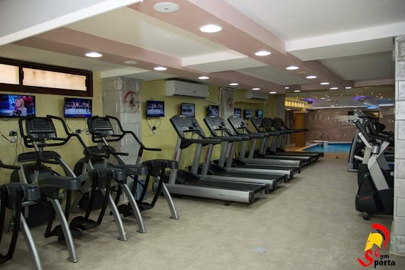
Gym nearby Crafters Gym
Egypt
Gym nearby Crafters Gym
Crafters Gym
365 ط، Al Haram, Giza Governorate, Egypt
contacts phone
:
+20 102 000 7777
Latitude:
29.9670662
, Longitude:
31.0908777
larger map & directions
read more
nearest Gym
143 m
صالون هلال للرجال Hair Desainer Man
Al Haram
Gym
read more
325 m
venus (beauty salon and fitness center )
Al Haram
Gym
read more
364 m
Center Venus
الجيش
Gym
read more
371 m
Sparta Gym Hdayek Al Ahram
الجيش
Gym
read more
502 m
the spa(حدائق الاهرام)
Al Haram, Qesm Boulaq Ad Dakrour
Gym
read more
510 m
Goal Gym
د ماجد محمد توفيق, Al Haram
Gym
read more
543 m
Relax Center
البوابه الثانيه
Gym
read more
745 m
Doctor Gym
مدارس اسباتس
Gym
read more
752 m
Doctor Gym Hadaba
Al Haram
Gym
read more
836 m
Pro Fit Gym
244 بجوار, البوابه الاولى لمدينه ضباط القوات المسلحه بالرمايه
Gym
read more
1.059 km
مركز الهضبه
76 الضغط العالي, Al Haram
Gym
read more
1.226 km
Bedaya Academy
Gym
read more
1.247 km
جمباز حدائق الاهرام
الضغط العالي
Gym
read more
1.387 km
Active Gym
شارع الخزان
Gym
read more
1.581 km
Ballerina Ballet Center
د ماجد محمد توفيق, ١٦٠ ع حدائق الاهرام البوابه الرابعه, Al Haram
Gym
read more
1.616 km
Power Gym
216 D, Hadayek Al Ahram
Gym
read more
1.701 km
Snap Health Club
Garana
Gym
read more
1.71 km
Gladiator Gym
Gym
read more
1.742 km
مركز الشفا التخسيس والعلاج الطبيعي
1 شارع حورس اخر شارع الوحده
Gym
read more
1.777 km
مركز الصفوة للعلاج الطبيعي
شارع مينا
Gym
read more
1.8 km
Sehaty Ladies & Kids Gym
105 b شارع احمد بدير, 105b Street 5, الجيزة
Gym
read more
1.856 km
Sparta Gym
Al Haram
Gym
read more
2.138 km
Fitness Egypt Jim Plateau
الثروة المعدنية،
Gym
read more
2.323 km
صالة مدينة 6 اكتوبر الرياضية
Gym
read more
2.325 km
Hall 6 October 6 Games
طريق الشاذلى ابنى بيتك 7
Gym
read more
📑
all categories
Accounting
Administrative area level 1
Administrative area level 2
Airport
Amusement park
Aquarium
Art gallery
Atm
Bakery
Bank
Bar
Beauty salon
Bicycle store
Book store
Bowling alley
Bus station
Cafe
Campground
Car dealer
Car rental
Car repair
Car wash
Casino
Cemetery
Church
City hall
Clothing store
Colloquial area
Convenience store
Courthouse
Dentist
Department store
Doctor
Electrician
Electronics store
Embassy
Finance
Fire station
Florist
Food
Funeral home
Furniture store
Gas station
General contractor
Grocery or supermarket
Gym
Hair care
Hardware store
Health
Home goods store
Hospital
Insurance agency
Jewelry store
Laundry
Lawyer
Library
Light rail station
Liquor store
Local government office
Locality
Locksmith
Lodging
Meal delivery
Meal takeaway
Mosque
Movie rental
Movie theater
Moving company
Museum
Natural feature
Neighborhood
Night club
Painter
Park
Parking
Pet store
Pharmacy
Physiotherapist
Place of worship
Plumber
Point of interest
Police
Political
Post office
Premise
Real estate agency
Restaurant
Roofing contractor
Route
Rv park, camping
School
Shoe store
Shopping mall
Spa
Stadium
Storage
Store
Subway station
Supermarket
Synagogue
Taxi stand
Train station
Transit station
Travel agency
University
Veterinary care
Zoo
administrative area level 3
sublocality level 1
↑