Bank nearby بنك كريدي اجريكول 6اكتوبر
Egypt
Bank nearby بنك كريدي اجريكول 6اكتوبر
بنك كريدي اجريكول 6اكتوبر
contacts phone
:
+20
Latitude:
29.9427408
, Longitude:
30.8934394
read more
nearest Bank
49 m
Abu Dhabi Islamic Bank
Street 26, 6th OF OCTOBER
Bank
read more
188 m
بنك كريدى اجريكول credit agricole bank
Bank
read more
196 m
The United Bank
سوق الجملة، السادس من اكتوبر، الجيزة
Bank
read more
204 m
المصرف المتحد اكتوبر مجمع البنوك
Bank
read more
229 m
Tha United Bank. بنك المصرف المتحد
Street 24
Bank
read more
235 m
Arab African International Bank
Street 26
Bank
read more
291 m
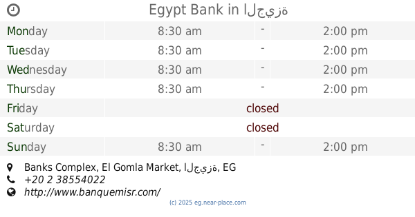
Egypt Bank
Banks Complex, El Gomla Market، 6th OF OCTOBER
Bank
read more
296 m
QNB ALAHLI
53 Street 26
Bank
read more
296 m
QNB Octobet Training Center
Bank
read more
327 m
Nasser Social Bank - NSB
4th Industrial Zone, banks Zone، 6th OF OCTOBER، الجيزة
Bank
read more
368 m
CIB
Industrial Road 22
Bank
read more
369 m
QNB Bank industrial Zone
Bank
read more
419 m
UNB-E 6th october
Bank
read more
447 m
Commercial International Bank
منطقة البنوك
Bank
read more
467 m
بنك مصر ايران للتنميه فرع 6 اكتوبر
Street 26
Bank
read more
522 m
Cairo Bank
Street 26
Bank
read more
688 m
First Abu Dhabi Bank
Industrial Road 22
Bank
read more
1.216 km
مخازن البنك الاهلى اكتوبر
No. 51
Bank
read more
1.248 km
Old HSBC Industrial Zone - Closed
Bank
read more
1.512 km
Industrial Development & Workers Bank Of Egypt
المجاورة العاشرة، السادس من اكتوبر، الجيزة
Bank
read more
1.904 km
بنك الكويت الوطني - المنطقة الصناعية - أكتوبر
Bank
read more
1.983 km
Credit Agricole Bank Store
Al Berins
Bank
read more
1.998 km
Housing & Development Bank - HDB حي 12
Bank
read more
2.001 km
Hdbank
62-64 Street 20
Bank
read more
2.187 km
Al Baraka Bank
Al Mehwar Al Markazi
Bank
read more
📑
all categories
Accounting
Administrative area level 1
Administrative area level 2
Airport
Amusement park
Aquarium
Art gallery
Atm
Bakery
Bank
Bar
Beauty salon
Bicycle store
Book store
Bowling alley
Bus station
Cafe
Campground
Car dealer
Car rental
Car repair
Car wash
Casino
Cemetery
Church
City hall
Clothing store
Colloquial area
Convenience store
Courthouse
Dentist
Department store
Doctor
Electrician
Electronics store
Embassy
Finance
Fire station
Florist
Food
Funeral home
Furniture store
Gas station
General contractor
Grocery or supermarket
Gym
Hair care
Hardware store
Health
Home goods store
Hospital
Insurance agency
Jewelry store
Laundry
Lawyer
Library
Light rail station
Liquor store
Local government office
Locality
Locksmith
Lodging
Meal delivery
Meal takeaway
Mosque
Movie rental
Movie theater
Moving company
Museum
Natural feature
Neighborhood
Night club
Painter
Park
Parking
Pet store
Pharmacy
Physiotherapist
Place of worship
Plumber
Point of interest
Police
Political
Post office
Premise
Real estate agency
Restaurant
Roofing contractor
Route
Rv park, camping
School
Shoe store
Shopping mall
Spa
Stadium
Storage
Store
Subway station
Supermarket
Synagogue
Taxi stand
Train station
Transit station
Travel agency
University
Veterinary care
Zoo
administrative area level 3
sublocality level 1
↑