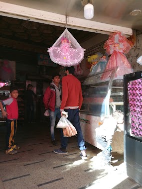
Bakery nearby Cake shop
Egypt
Bakery nearby Cake shop
Cake shop
٤عيد نافع محطة المساحة فيصل بجوار محل رشا و راندا Cairo egypt Egypt
contacts phone
:
+20
Latitude:
30.0021682
, Longitude:
31.1694268
read more
nearest Bakery
204 m
Dahab Pastry & Bakery
314 faisal st.، FAISAL، الجيزة
Bakery
read more
391 m
El Othmane
Oula Al Haram, Al Omraneyah
Bakery
read more
474 m
El Abd
256 ش فيصل، فيصل، الجيزة
Bakery
read more
497 m
C'est La Vie
Oula Al Haram, Al Omraneyah
Bakery
read more
604 m
El Zohour Bakery
30 Amr Ibn El Aas St.، FAISAL، الجيزة
Bakery
read more
636 m
Mandrin
At Talbeyah Al Qebleyah, Al Omraneyah
Bakery
read more
647 m
Boha
Monshaat Al Bakari, Al Haram
Bakery
read more
684 m
Maka
Kafr Tohormos /B, Qesm Boulaq Ad Dakrour
Bakery
read more
812 m
Atef Azouz
Monshaat Al Bakari, Al Haram
Bakery
read more
812 m
Salé Sucré Pâtisserie
307 Al Haram, Oula Al Haram, Al Omraneyah
Bakery
read more
875 m
Oval Cakes
Kafr Tohormos /B, Qesm Boulaq Ad Dakrour
Bakery
read more
900 m
El Harameen
11 Al Haram
Bakery
read more
931 m
Caramel Bakery
El-Salam, At Talbeyah Al Qebleyah, Al Omraneyah
Bakery
read more
1.022 km
El Samah
Atati, Al Haram
Bakery
read more
1.106 km
مخبز الحمد 2
Al Kom Al Akhdar, Al Omraneyah
Bakery
read more
1.277 km
HB Gawwadi
El-Arish, Oula Al Haram, Al Omraneyah
Bakery
read more
1.438 km
Knights (1)
Al Sheikh Rehan Road, Kafr Tohormos /B, Qesm Boulaq Ad Dakrour
Bakery
read more
1.564 km
Jawhara oven
Abdoun Bashir, Atati, Al Haram
Bakery
read more
1.64 km
Frot Land
Kafr Tohormos, Qesm Boulaq Ad Dakrour
Bakery
read more
1.941 km
Melouk El Kasab
At Talbeyah Al Qebleyah, Al Omraneyah
Bakery
read more
1.976 km
El Fares
Monshaat Alian, Qesm Boulaq Ad Dakrour
Bakery
read more
1.997 km
Fataer Kawkab El Sharq
51 تقاطع ش الثلاثينى، فيصل، الجيزة
Bakery
read more
2.021 km
El Abd
118 ش فيصل، فيصل، الجيزة
Bakery
read more
2.361 km
Ebad El Rahman
Nazlet Khalaf, Qesm Boulaq Ad Dakrour
Bakery
read more
2.656 km
El-Rayan Patisseries
Nazlet Al Batran, Al Haram
Bakery
read more
📑
all categories
Accounting
Administrative area level 1
Administrative area level 2
Airport
Amusement park
Aquarium
Art gallery
Atm
Bakery
Bank
Bar
Beauty salon
Bicycle store
Book store
Bowling alley
Bus station
Cafe
Campground
Car dealer
Car rental
Car repair
Car wash
Casino
Cemetery
Church
City hall
Clothing store
Colloquial area
Convenience store
Courthouse
Dentist
Department store
Doctor
Electrician
Electronics store
Embassy
Finance
Fire station
Florist
Food
Funeral home
Furniture store
Gas station
General contractor
Grocery or supermarket
Gym
Hair care
Hardware store
Health
Home goods store
Hospital
Insurance agency
Jewelry store
Laundry
Lawyer
Library
Light rail station
Liquor store
Local government office
Locality
Locksmith
Lodging
Meal delivery
Meal takeaway
Mosque
Movie rental
Movie theater
Moving company
Museum
Natural feature
Neighborhood
Night club
Painter
Park
Parking
Pet store
Pharmacy
Physiotherapist
Place of worship
Plumber
Point of interest
Police
Political
Post office
Premise
Real estate agency
Restaurant
Roofing contractor
Route
Rv park, camping
School
Shoe store
Shopping mall
Spa
Stadium
Storage
Store
Subway station
Supermarket
Synagogue
Taxi stand
Train station
Transit station
Travel agency
University
Veterinary care
Zoo
administrative area level 3
sublocality level 1
↑